Busan
U.S. Consulate in Busan
Room 612, Lotte Gold Rose Bldg., 993 Jungang-daero, Busanjin-gu, Busan 47209
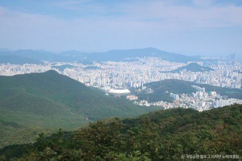
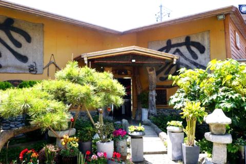
Photo: ⓒKorea Tourism Organization · KOGL Type 3 · No modification · Copyright policy
Baegyangsan Mountain is located on the main ridge of the Geumjeongsan Mountain range, which forms the boundary between Busanjin-gu and Sasang-gu. Although the place name is not recorded in documents from 1740, its name is derived from the relationship between Baegyangsa Temple and Geumyongsan Mountain. On the southern slope, there is the site of Dongpyeong County fortress from the Three Kingdoms period, and at the foot of the eastern slope, Seonamsa Temple is located.
Description based on Korea Tourism Organization (in Korean) · Summarized by AI from official sources
This is an AI (machine) translation. Please check important details such as prices and hours in the Korean original. View Korean original
In Korea, Google Maps only gives public transit directions.
No reviews yet Leave a review and earn +50P!
Log in to write the first reviewIn an emergency, call right away. 112 and 119 are free and can connect an interpreter.
Good to know
Room 612, Lotte Gold Rose Bldg., 993 Jungang-daero, Busanjin-gu, Busan 47209
188 Sejong-daero, Jongno-gu, Seoul 03141
24 Sejong-daero 19-gil, Jung-gu, Seoul 04519
c/o Dongsung Group, 2F, 99 Sinsan-ro, Saha-gu, Busan 49421
21 Jeongdong-gil (Jeong-dong), Jung-gu, Seoul 04518
19th Floor, Kyobo Building, 1 Jong-ro, Jongno-gu, Seoul 03154
3rd floor, Pan Star Cruise Plaza, 3 Jungang-dong 2-ga, Jung-gu, Busan
8th Floor, Jeong Dong Building, 21-15 Jeongdong-gil, Jung-gu, Seoul 04518
18 Gogwan-ro, Dong-gu, Busan 48792
Twin Tree Tower A, 6 Yulgok-ro, Jongno-gu, Seoul 03142 (Consular Section 8F)
25 Haeundae-ro 394beon-gil, Haeundae-gu, Busan 48089
27 Myeongdong 2-gil, Jung-gu, Seoul 04536
9F, Dongwon Industries Bldg., 70 Jungang-daero, Jung-gu, Busan 48941
6F, Gwanghwamun Building, 149 Sejong-daero, Jongno-gu, Seoul 03186
17 Hannam-daero 36-gil, Yongsan-gu, Seoul 04417
17F, Twin Tree Tower B, 6 Yulgok-ro, Jongno-gu, Seoul 03142
#718, Byuksan e-Centum Class One Bldg., 99 Centumdong-ro, Haeundae-gu, Busan 48059 (Consular Section #311)
123 Bukchon-ro, Jongno-gu, Seoul 03052
42 Daesagwan-ro, Yongsan-gu, Seoul 04402
101 Dokseodang-ro, Hannam-dong, Yongsan-gu, Seoul 04419
1147-13 Choryang-dong, Dong-gu, Busan (near Choryang Station exit 5)
80 Hoenamu-ro, Yongsan-gu, Seoul 04346
380 Yeouidaebang-ro, Yeongdeungpo-gu, Seoul 07342
129 Dokseodang-ro, Hannam-dong, Yongsan-gu, Seoul 04419
28th Fl., Seoul Finance Center, 136 Sejong-daero, Jung-gu, Seoul 04520
8F, KEB Hana Bank Bldg., 94 Jungang-daero, Jung-gu, Busan 48939
43 Seosomun-ro 11-gil, Jung-gu, Seoul 04516
11 Haeun-daero 774beon-gil, Haeundae-gu, Busan 48104
95 Dokseodang-ro, Yongsan-gu, Seoul
43-12 Seosomun-ro, Seodaemun-gu, Seoul 03741
2F, Busan Tourist Hotel Annex, 24 Gwangbok-ro 97beon-gil, Jung-gu, Busan 48955
8F, Seoul Square, 416 Hangang-daero, Jung-gu, Seoul 04637
Pick your nationality to see the Busan consulate and Seoul embassy contacts.
Lost passport, arrest or serious accident? Contact your embassy or consulate right away. · Verified on 2026-09-19
Allow location to see the nearest emergency rooms and pharmacies on the map.
Call ahead to confirm the emergency room can see you. Live ER status (E-Gen, Korean) ↗
Generative AI chatbot · Answers may be wrong
Hi! I’m Booki
I'm a Busan guide chatbot that answers with generative AI. Ask me about food, sights, weather or directions. Answers can be wrong, so please double-check important details with official sources.